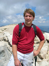
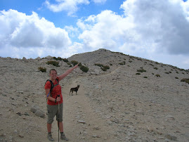
This is a great hike to do in Running Springs. In the early season there are several creeks that you pass as you are hiking. Late in the fall they are all dry. The trail starts at the bottom of Keller Peak road. You need a Forest Adventure Pass which is 5 dollars for the day or 30 dollars for the year in order to park at the trail head. If the road is open another option is hiking it down only by parking at the top of the trail 4 miles up the road. The trail does not follow close to the road and you can not hop on and off where you want. The views are also very different from the road drive so do not expect that you have seen it all by driving there.
The Exploration trail is one of the best graded trails I have ever hiked on. It is a very steady climb and it has beautiful rock formations and much of the hike is in the trees. It is also an excellent place for Mountain Biking and trail running. At the top of the trail you can go right and continue up to the top of Keller Peak which is 7781 feet. Or you can continue up to Slide Peak 7841 feet. Both offer a beautiful panoramic view of the entire Southern California area including Palomar Mountain, San Bernardino Peak, LA sky scrapers, Big Bear Lake and much more. The view is worth hiking all the way to the top.
My favorite times to hike this trail are in the early spring before the road opens and in the fall when the fall colors are out. There are many oaks around they are beautiful in the fall. It would also be a fun snow shoe hike in the winter time.
Showing posts with label Hiking. Show all posts
Showing posts with label Hiking. Show all posts
Thursday, August 20, 2009


Hiking
There are many places to hike in the San Bernardino Mountains. But it is hard to find them so I am working on composing a good list. Come back from time to time for updates to the list.
Deep Creek
Heaps Peak Arboretum .9 mile walk on nice path.
Keller Peak Exploration Trail 4-6 miles hike each way depending on where you go
Lake View Point Trail-
San Gorgonio 16 mile hike to top of tallest peak in Southern California.
Deep Creek
Heaps Peak Arboretum .9 mile walk on nice path.
Keller Peak Exploration Trail 4-6 miles hike each way depending on where you go
Lake View Point Trail-
San Gorgonio 16 mile hike to top of tallest peak in Southern California.
Friday, August 7, 2009
Heaps Peak Arboretum
I took a walk with the kids to the Arboretum this morning. It was nice and cool about 60 degrees. There wasn't much of a breeze but there often is when you are walking there so it is good to be prepared. The Arboretum is the perfect place to take preschool age children hiking. It is located on highway 18 between Running Springs and Lake Arrowhead. You need to have a forest adventure pass to park which costs $5.00 and can be obtained at the forest service station and at Deer Lick Lumber in Running Springs. The trail is partially paved and mostly hard packed dirt. It is very easy for every kind of hiker. The paved section of the trail goes to the bathrooms and is wheel-chair accessible. (Thanks to an eagle scout project by my mountain man.)
We started the hike by walking around a small loop of concrete at the right of the enterance. In the concrete are the footprints of many different kinds of animals. The kids love to look at all of them. You could bring along paper and crayons and take rubbings of each kind of foot print. There are also picnic tables at the front for bringing lunches.
After walking the small loop we started down the concrete path towards the bathrooms. After the bathrooms the trail is packed dirt. Along the trail there are tons of different kinds of plants including a grove of Sequoia trees that are quite tall and are scarred from the recent fire ('03) and a grove of dogwoods. The dogwoods were starting to change already. There are bridges to cross and a couple of streams that were dry this time of the year but would be wet in the spring. The trail ends where you start and the full loop is 7/10 of a mile.
We started the hike by walking around a small loop of concrete at the right of the enterance. In the concrete are the footprints of many different kinds of animals. The kids love to look at all of them. You could bring along paper and crayons and take rubbings of each kind of foot print. There are also picnic tables at the front for bringing lunches.
After walking the small loop we started down the concrete path towards the bathrooms. After the bathrooms the trail is packed dirt. Along the trail there are tons of different kinds of plants including a grove of Sequoia trees that are quite tall and are scarred from the recent fire ('03) and a grove of dogwoods. The dogwoods were starting to change already. There are bridges to cross and a couple of streams that were dry this time of the year but would be wet in the spring. The trail ends where you start and the full loop is 7/10 of a mile.
Hiking San Gorgonio
 San Gorgonio is the tallest mountain in Southern California and I have always wanted to hike it. So we planned to do it on July 3rd. We got up at 4:oo am on Friday and picked up our babysitter. (She is a wonderful girl who loves to hike too and understands that you need to start early to hike some mountains.) Then we drove to the trail head at Vivian Creek. At about 5:50 we were hiking. The picture is us smiling because we have not started hiking yet.
Here is a pictures of the switchbacks that are at the start of the trail. The first mile is a grueling climb off the valley floor full of very steep switchbacks.
 This is a picture looking up at the Yucaipa Ridge.

 Here is a picture looking at the San Gabriel Mountains from the switchbacks. Isn't it beautiful?
 After the killer switchbacks you come upon a meadow and creek called Vivian Creek. It is beautiful up there. There is a creek running and some very tall Ponderosa and Cedar trees with very wide bases. The trail levels out and becomes enjoyable. There were wildflowers everywhere! We enjoyed looking at the flowers and decided to keep hiking a bit further before stopping for breakfast. We hiked along the creek which was dry in this area. The trail is easy with gentle elevation gains and seems to be a little Roley.
 We kept thinking we would wait and eat at Halfway Camp but Mountain Man and I got hungry and so we stopped on a rock and ate our muffins. While we were eating a hippie man passed us. I was surprised by the number of people hiking by themselves. Have these people never heard that taking a buddy is always a good idea?
After our breakfast we had energy and we continued to hike past half way camp. Here the creek came above ground for the camp. After half-way point the trail turns into a couple of very long switchbacks. The trail has been remade from when Mountain Man hiked it and we loved the views of Yucaipa Ridge and then when we went the other way we could see into the canyon.
We stopped at high creek and pumped water and took a short break. Then we headed up the silliest switchbacks ever. I was kind of glad they were so shallow and flat because I got a really bad headache from altitude but Excedrin saved me!


 This is a great picture of San Bernardino peak


 After awhile the trail switched into the alpine and the trail became very steep. Then our endurance set in and we trudged along for a long ways up the shoulder. I knew that we couldn't see the top based on past experiences but I kept imagining that the top was just right over there.
Finally Mountain Man showed me the top of the mountain. I could see some people standing there and knew that it was the top. I was pretty excited to see it. San Gorgonio is 11,500 feet and the trail is 8 miles each way. The elevation gain is 5500 feet. It was the longest accent to the top of a mountain I have done so far and I am very proud of the accomplishment.
This is the top of the mountain right there and yes I am excited to see it!
 We made it!
 Mountain Man looking like the rugged mountaineer that he is.
 This is a picture of the big tree in the meadow on the way down.
 The hike down was the standard hike down from the top of a mountain. I hike too slow down hill trying to be sure of each step and it takes much longer than it should. I was grateful for the trekking pole which seemed to help some with hiking a little faster. We stopped at high creek again and got more water and rested. We passed a lot of people heading up to the top. Mountain Man talked to and instructed lots of them while I just wanted to keep hiking. My knees hurt like crazy the last mile and I really wanted to sit down and cry a little but instead just kept hiking. We made it to the parking lot and sat down in the car glad that we were done for the day.
Subscribe to:
Posts (Atom)